Pharmacy
Regulatory compliance, temperature control and full traceability.
Optimisation
&UP® Optimisation helps to design areas, plan routes and quickly adapt the schedule to changes throughout the day. The system utilises operational and geospatial data, ensuring that planning is based on a real-time picture of the network.








A dispatch centre is ideal for sectors where the day-to-day coordination of a large number of deliveries to multiple recipients requires a centralised tool
Long-term planning of a company’s operational and logistical structure, looking ahead over quarters and years. Developing operational scenarios based on geographical data, order volumes and market potential:
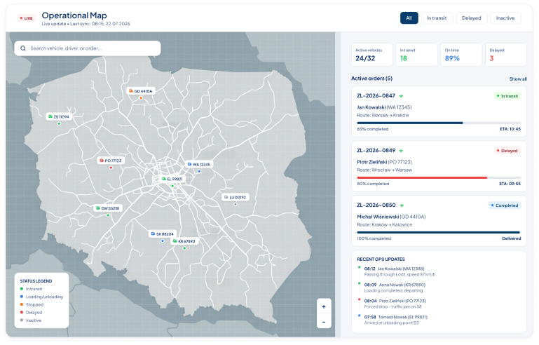
Medium-term operational planning based on historical data, forecasts and known organisational conditions. Assigning zone and route plans to specific days in the operational calendar, with ongoing analysis of efficiency:
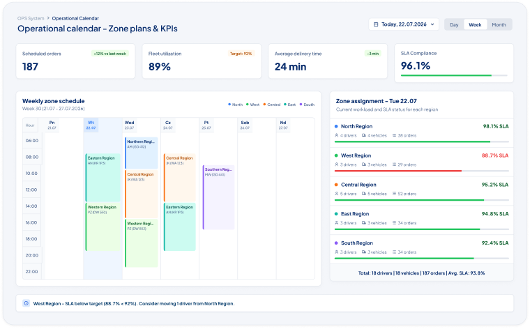
Ongoing route adjustments and real-time responses to changing road and operational conditions. Full integration with the carrier’s mobile app ensures that vehicle location data and order statuses are always up to date. Algorithms tailored to different types of operations:
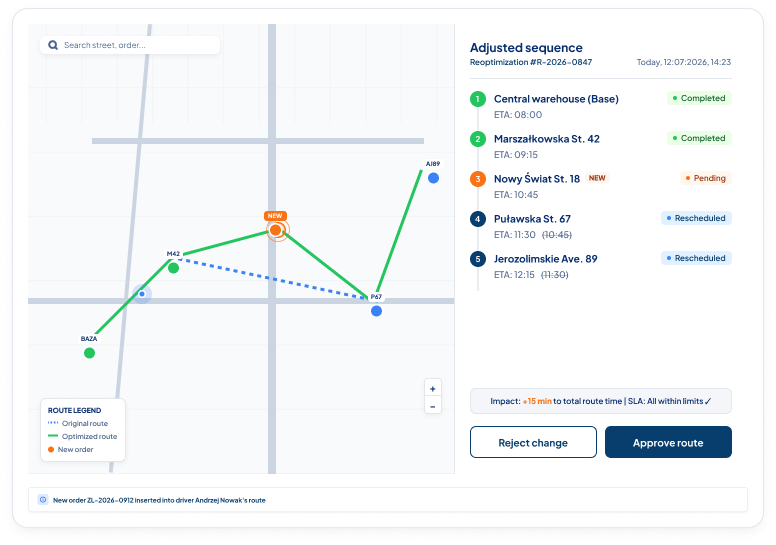
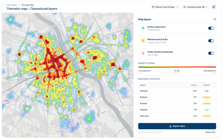
Full integration with GIS systems enables advanced spatial analysis and the creation of an intelligent operational map.
During a free consultation, we will show you how &UP® can help streamline specific areas of your operations.
Book a consultation
Shorter routes, better utilisation of the fleet and reduced fuel consumption.

Taking time windows into account at the planning stage.

Dynamic re-optimisation allows you to respond without affecting the ETA.

‘What-if’ scenarios illustrate the consequences prior to the investment.
-25%
kilometres along the route
+18%
parcels in transit
-20%
fuel costs
+95%
deliveries within time slots
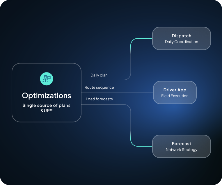
Optimisations form the planning layer of the &UP® platform.
As a result, the network development strategy, the operational plan and on-the-ground implementation are all based on the same data and business rules.
See what the workflow looks like.
The system collects forecast and actual volumes from the Forecast and Shipper Portal modules.
The VRP and TSP algorithms organise zones and route sequences whilst taking all business rules into account.
The plan is sent to the dispatcher for approval or automatically to the execution module.
Throughout the day, the system responds to anomalies and suggests adjustments to the plan.